Saturday, May 31st
Well, Saturday was my day to forecast with my forecast partner Scott, and what a day it was!
The forecast for the day was a bit rough, with parameters better than Friday, but not ideal for tornadic supercell development. Eastern Wyoming was our targeted area for the day with a Slight Risk issued by the SPC.
A higher risk for damaging winds was issues for Montana, but we didn’t want to travel all the way north to miss the action in Kansas on Sunday, which had much better parameters. CAPE was sufficient with around 1500-2000 J/kg and shear was around 30-40 knots. Shear isn’t enough to create a full-blown supercell, but a quasi-supercell was forecasted to potentially occur. A low-level trough was forecasted to move through Wyoming to initiate the lifting factor for the severe weather. In addition, a low-level jet is bringing in extra moisture from the southwest to further fuel the system. The concerns that we had for the day were the convective inhibition (CIN), sufficient diabatic heating (sunshine), and surface dewpoint. CIN was right around 100 J/kg, so the cap on the convection was somewhat strong and there was worry that the cap wouldn’t ever break to let the convection go. However, we had hope in the low-level trough, negative omega values, and vorticity advection to supply enough lift to help break the cap. A cloud deck had formed over eastern Wyoming and western Nebraska early in the morning, so there was a major concern for diabatic heating. In fact, western Nebraska was forecasted to have better CAPE, but because of the cloud deck, the diabatic heating that destabalizes the air wouldn’t start until the afternoon when the clouds cleared. Luckily, though, the cloud deck over Wyoming wasn’t as aggressive as the one over Nebraska and gave way in the morning. Surface dewpoint was fairly low for this day, only being in the upper 50s, what is usually not enough for good moisture. However, Dr. Decker pointed out that since we were in the high plains over 5,000 feet above sea level and, at that elevation, you don’t need dew points in the upper 60s or 70s. “That’s the magic of the high plains,” he said. And magic it sure was.
We headed to the small town to Lusk, WY to sit and wait for convection to start. This wait caused extra anxiety for me since the entire day counted on the forecast Scott and I made. And since Scott is just a senior and I already graduated, there was, I felt, more pressure on me to guide. The cool, drier air of the higher elevations made myself and others nervous about initiation of convection. Some really nice locals provided company to the group, throwing around a frisbee and playing some basketball while comparing and contrasting the cultures of the eastern and western US. Evidently, the three of them were fans of Doctor Who as well! Without a doubt, that was a long conversation between “Whovians.” There was also another storm chasing group (or even two) that were in the same park as us-heck, they even got lunch at the same place as us! Quite frankly, though, they weren’t too friendly, and also seemed a bit odd, as their van’s grille had what looked like a dead baby doll tied to it… I wish I had a picture of it to show you, but just take my word for it. I also wasn’t the only one that noticed it… In the words of Matt DeLucia, “I guess Twister wasn’t too far off…”
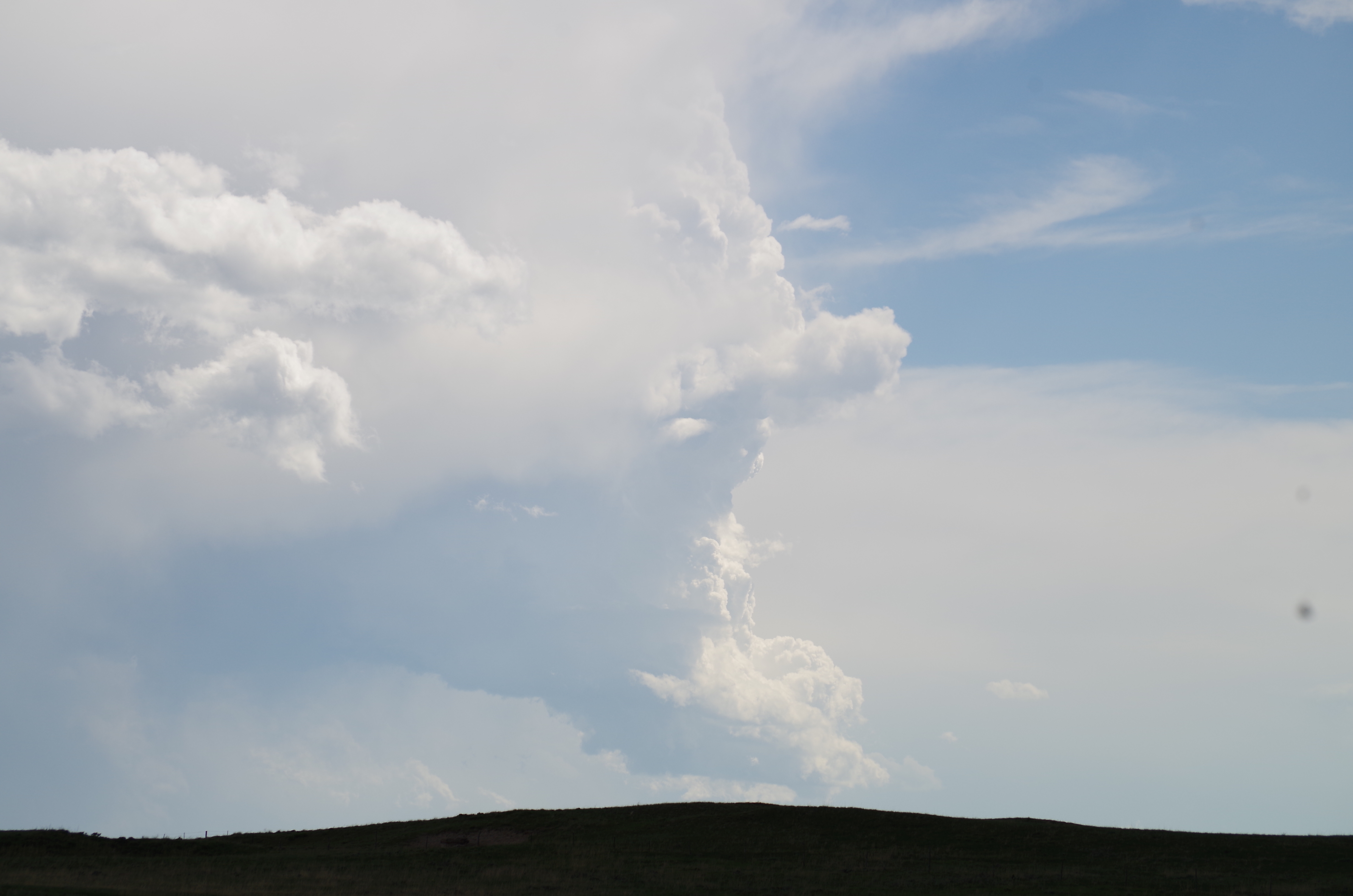
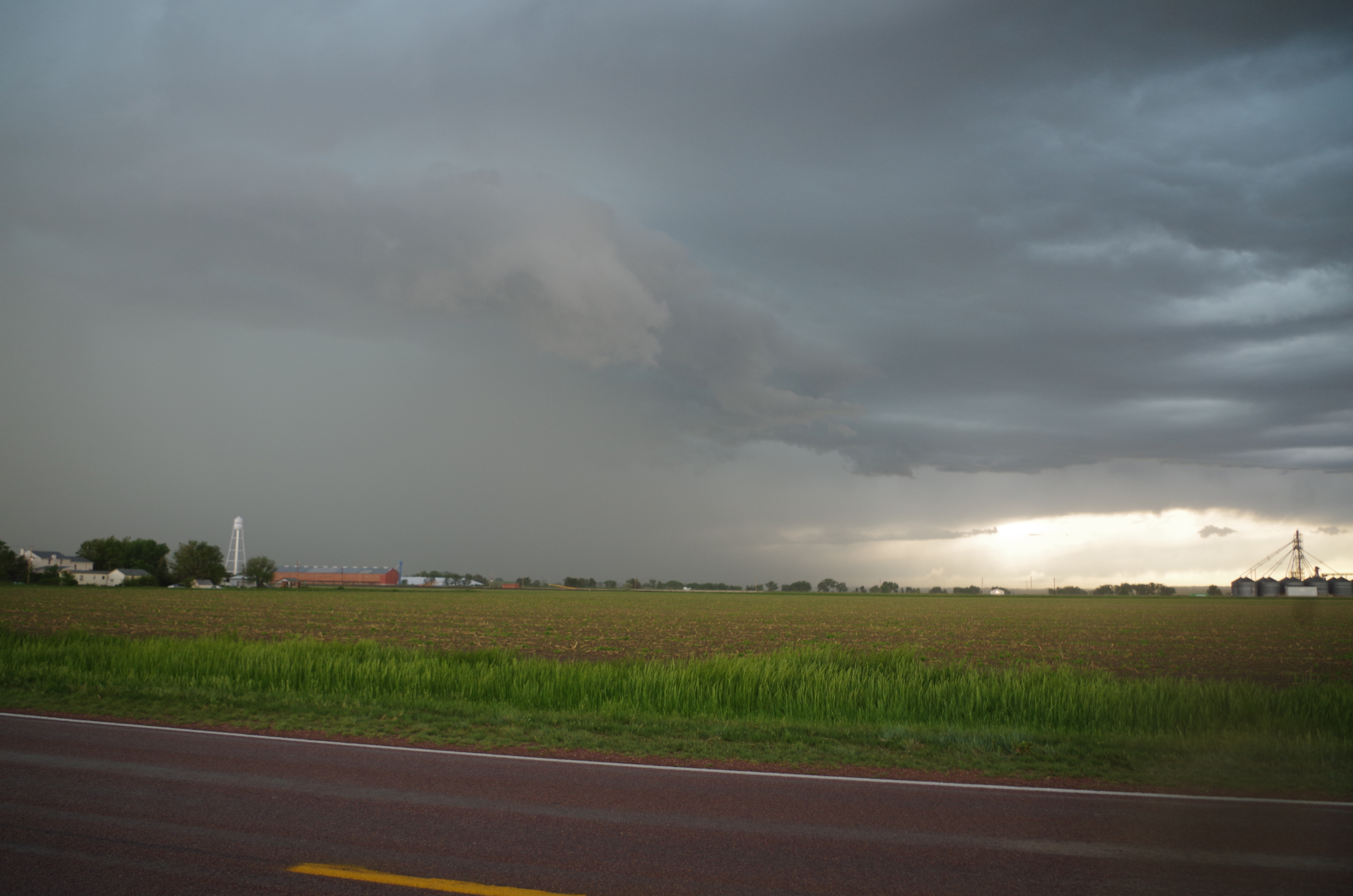
After some long and gruling hours of waiting, convection did begin to fire up. One storm was just WSW of Lusk and started to look really good, so, in a blink of an eye, went right into active chase mode and began persuing this cell. We traveled west then south to intercept this storm, but by the time we got there, it didn’t look as impressive as it did beforehand.
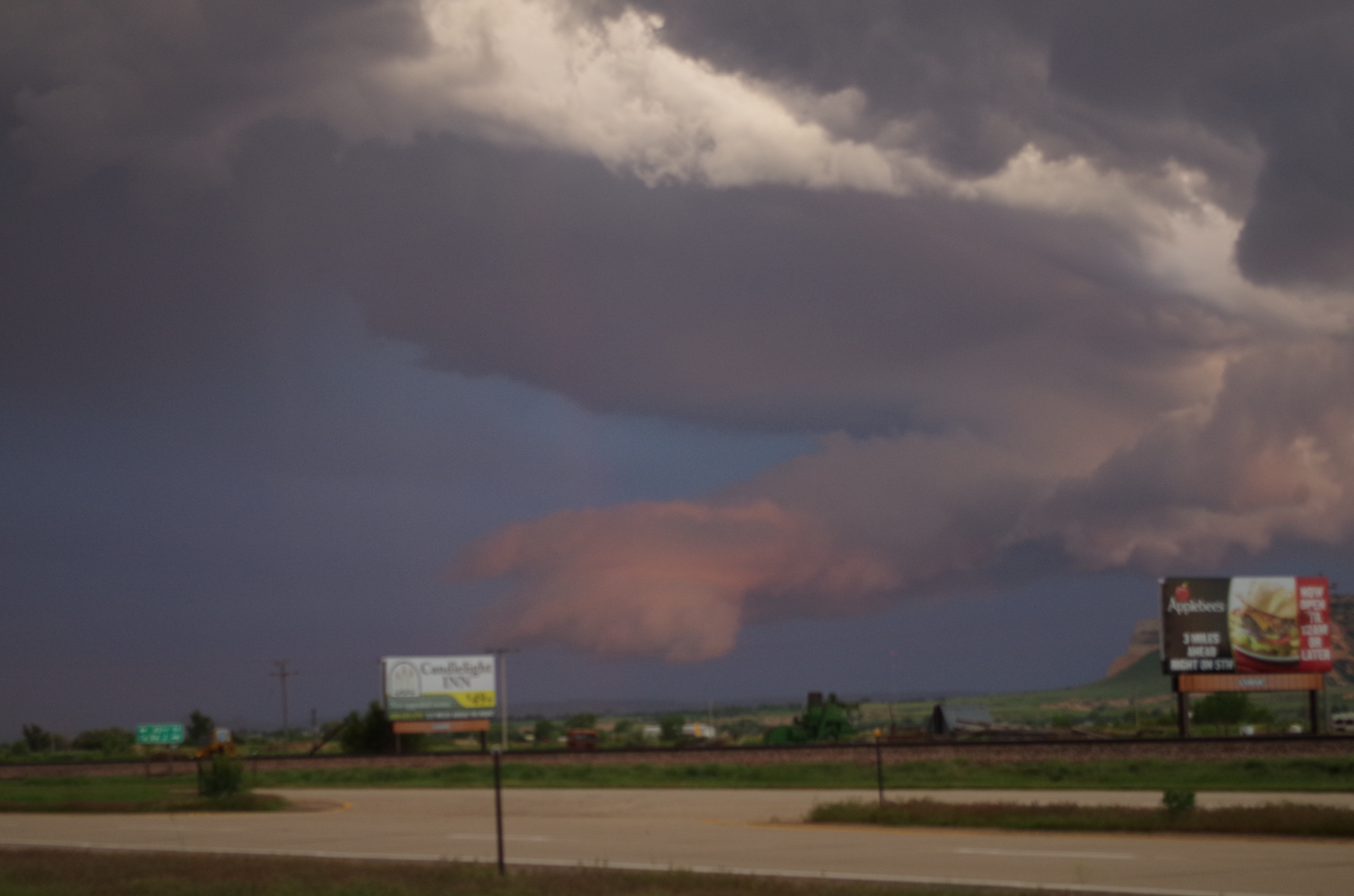
However, it was starting to shift from a ENE movement to a due east movement, which meant it was right in our path. Thus, we drove South to get into a safer distance from the storm with a decent view. But, that road south lead us into the hills of the High Plains (which I didn’t know existed in the plains; I just assumed it was all flat), so we never found a good area to view it. Stopping at a town with a name (sorry, can’t remember the name of it), we re-assessed the situation momentarily. Another cell had developed to our south around Chugwater, WY, so we had to choose between the cell north of us nearby Lusk or south of us in Chugwater.
The Lusk cells had a more linear complex to them, which didn’t really favor supercell development and was more of a multicellular system than supercell, which wasn’t what we were looking for today. The Chugwater cell was a single cell, separate from any surrounding cells, so it had a better chance to become more like a supercell. In addition, radar detected weak rotation in the cell, suggesting it was becoming more supercellular. Dr. Decker gave Scott and I the call to choose which cell to pursue and with that information at hand, we decided on the southern cell in Chugwater. No more than 5 minutes later, the NWS issued a tornado warning on that cell as a funnel cloud was reported by law enforcement. In that blink of an eye, we were chasing a tornado warned quasi-supercell thunderstorm!
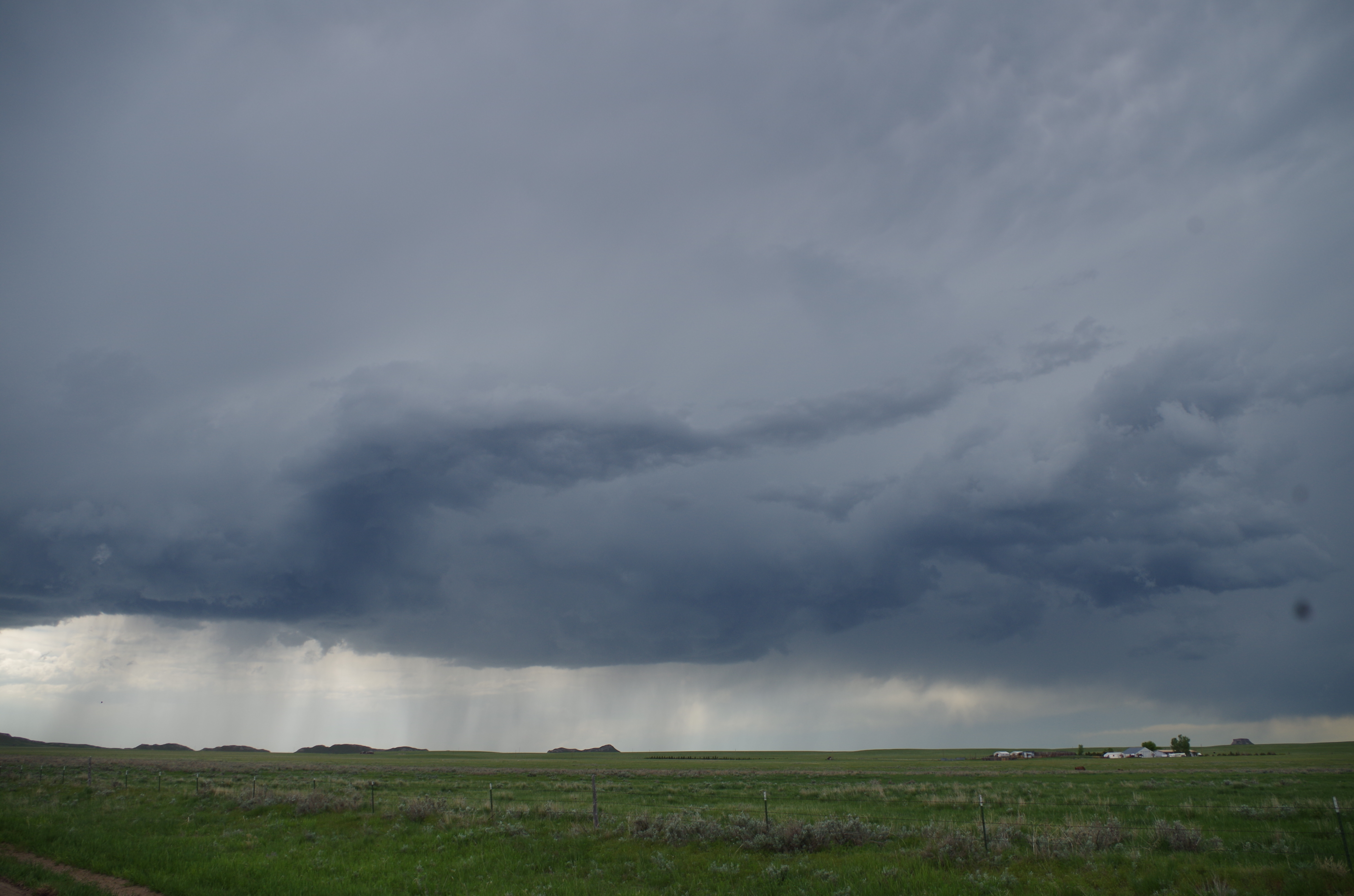
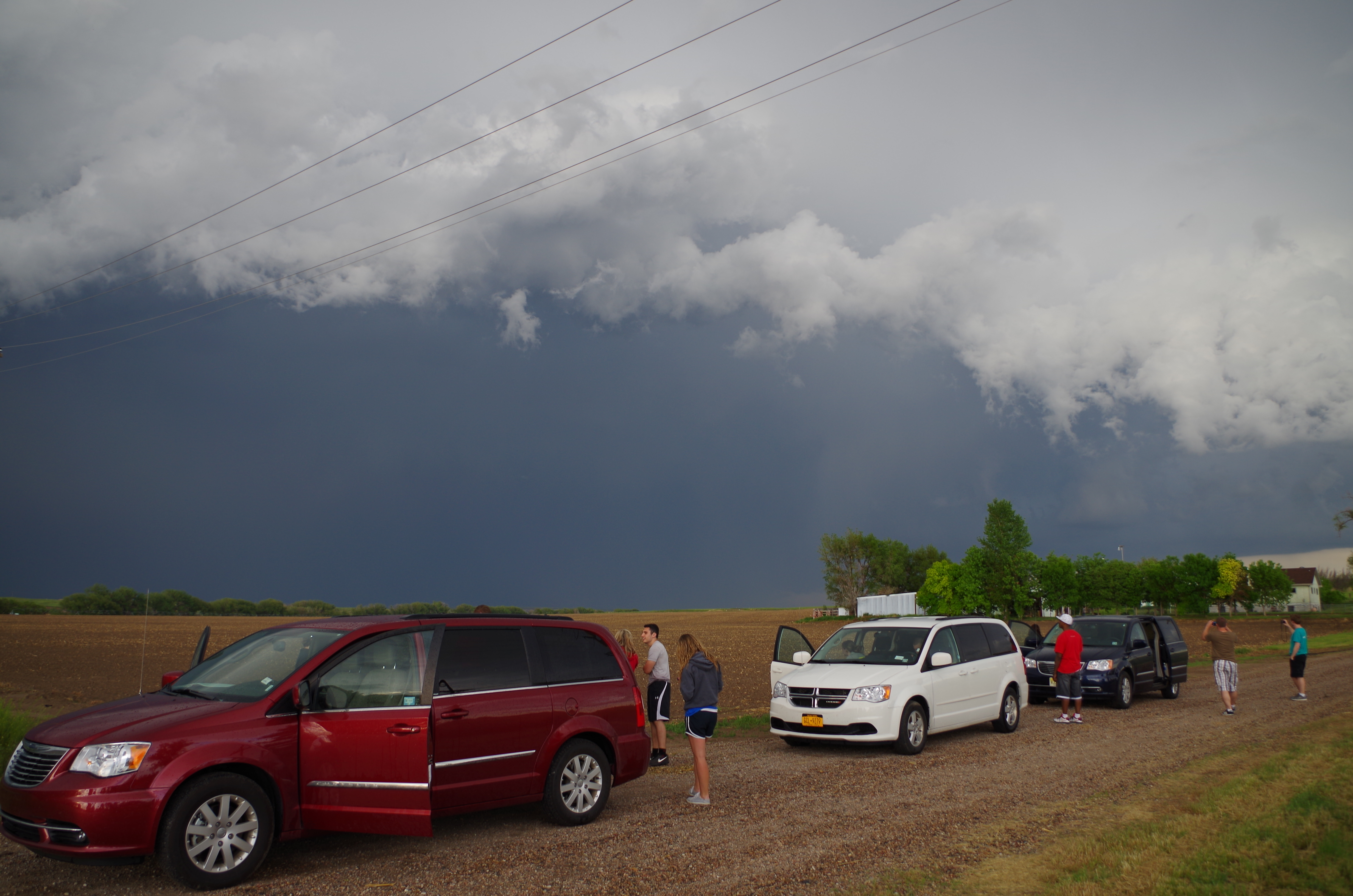
We raced south and east to locate ourselves in an ideal position to view the storm (southeast corner). Getting there, however, was a bit interesting. Firstly, the view of the storm was unbelievable. It was a massive storm cell with a low cloud base and good inflow. In addition, there were tons of mysterious scuds that looked like tornadoes (what at tease!). The rain shaft and hail core were fully visible as well while we punched southward.
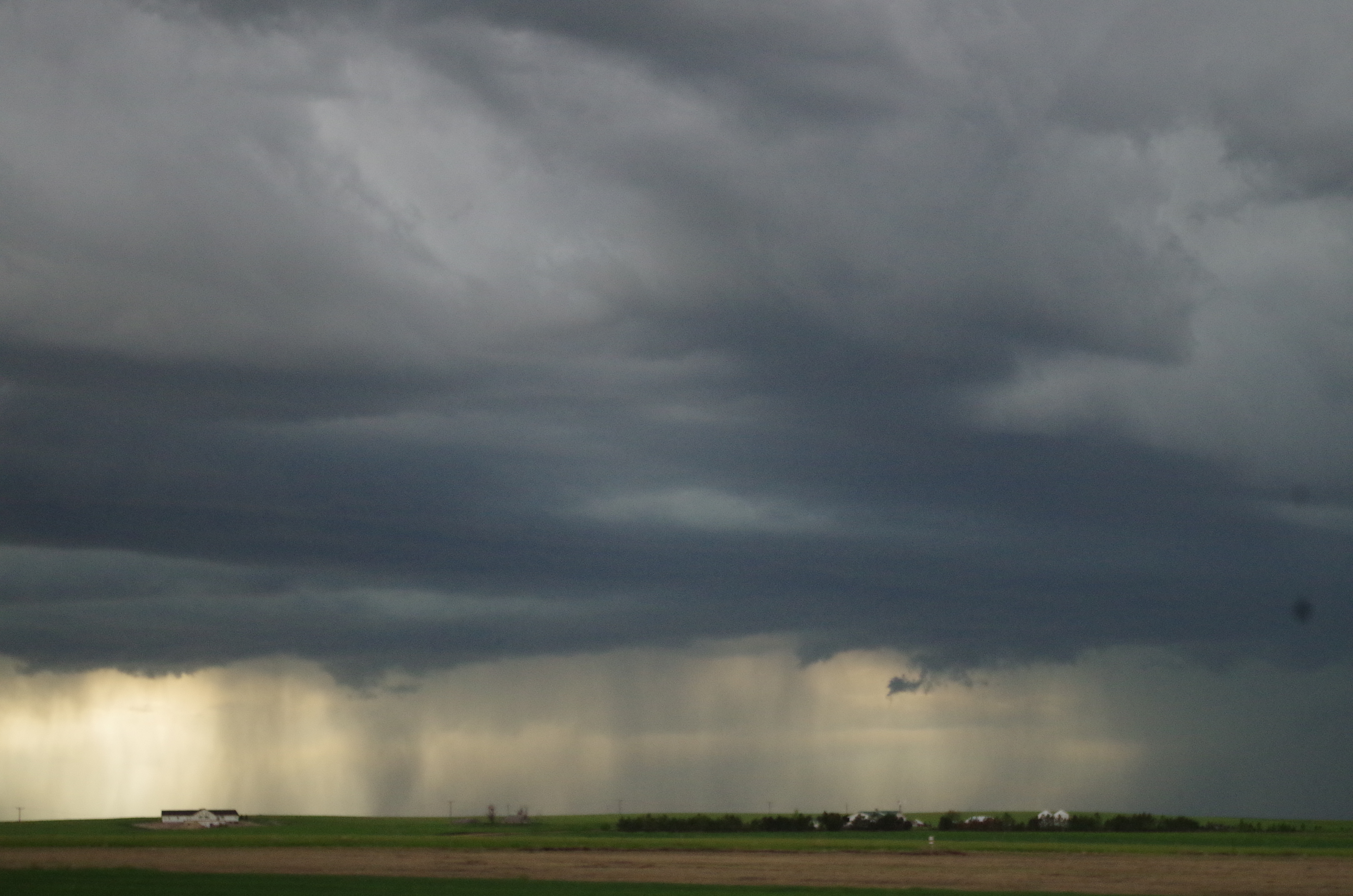
Vertically Integrated Liquid (or VIL), a measurement of thunderstorm updrafts, and echo tops (how tall the storm is) were extremely high for this storm as we were chasing. But, by the time we got to our target location, the storm was losing its strength and the tornado warning was dropped. It also soon dropped its severe thunderstorm characteristics. However, it was still a monster of a storm. Lightning was frequent and winds were intense. At one point, we even had to pull over shortly to allow a small break-off of the thunderstorm to pass.
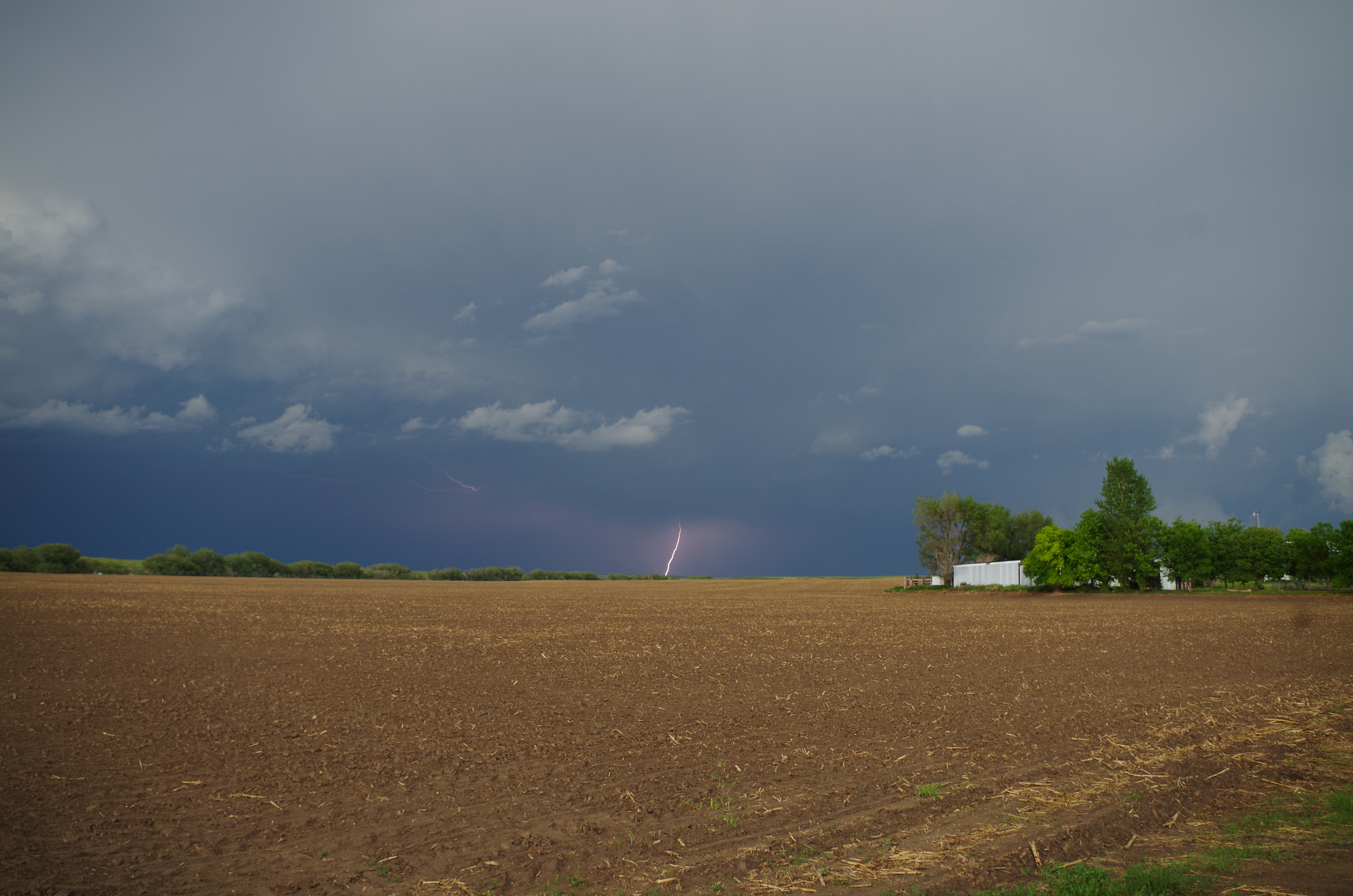
We kept with the storm for a little bit and pulled into a dirt road (which I’m pretty sure was someone’s driveway) to get a better look. The view was quite incredible as the storm passed, showing off some interesting cloud formations and some decent lightning.
Taking the opportunity, I set my camera to the multi-shoot mode and fired away at 6 pictures a second to catch that perfect lightning bolt. Now, if you’ve ever tried to take a picture of lightning, regardless of what camera you’re using or how fast your camera is, it’s extremely frustrating and the standard rules apply: if you’re looking, shooting, or recording, nothing will happen. The moment you look away or stop recording, Mother Nature unleashes the most amazing lightning performance ever, only to cease immediately before you take another photo or press record again. It wasn’t until after maybe 500 photos later did I get ONE lightning shot.
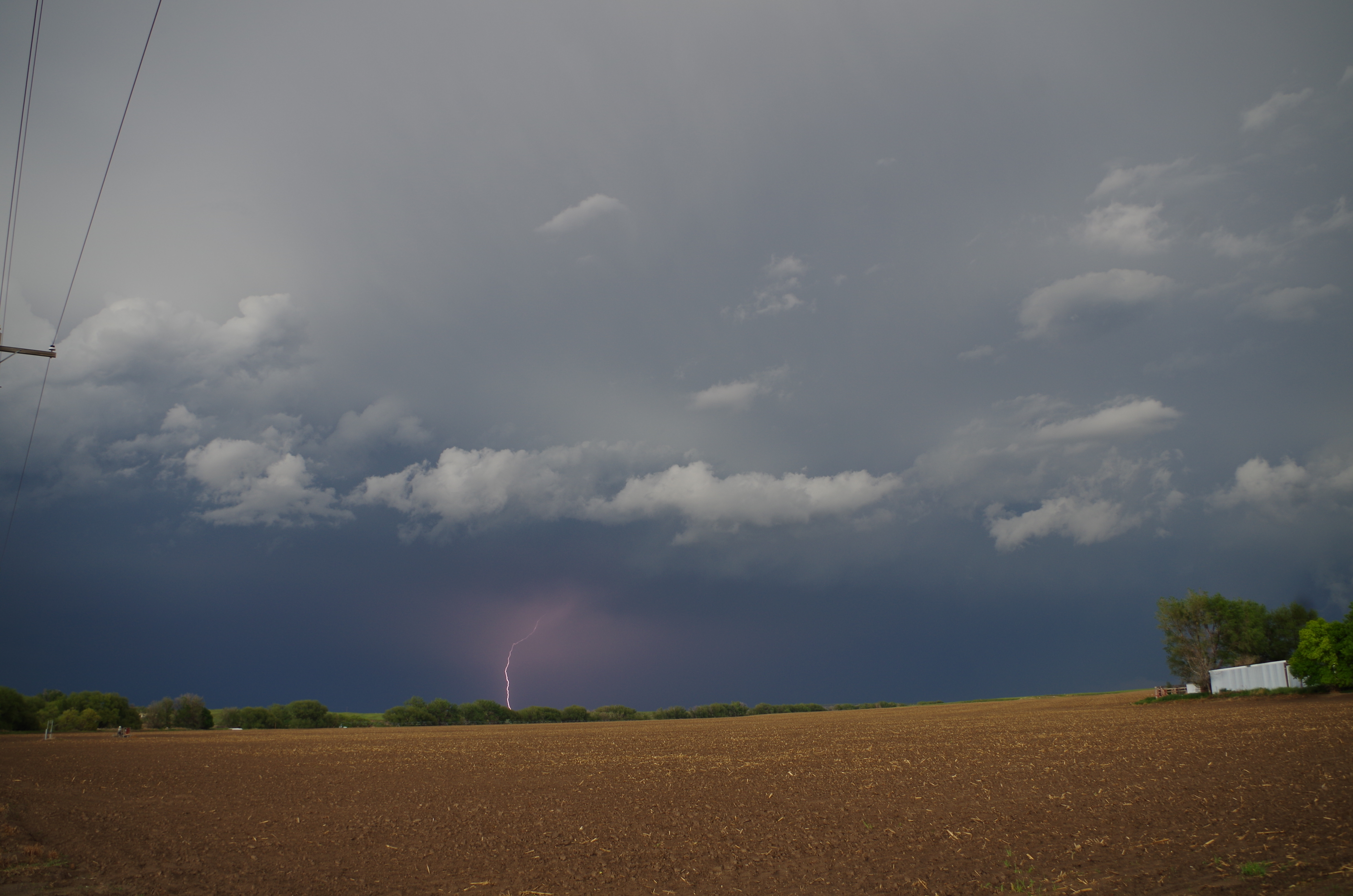
Extremely overjoyed, I decided to try and get another shot again. After about another 300 photos, and countless misses, I got a second lightning photo.
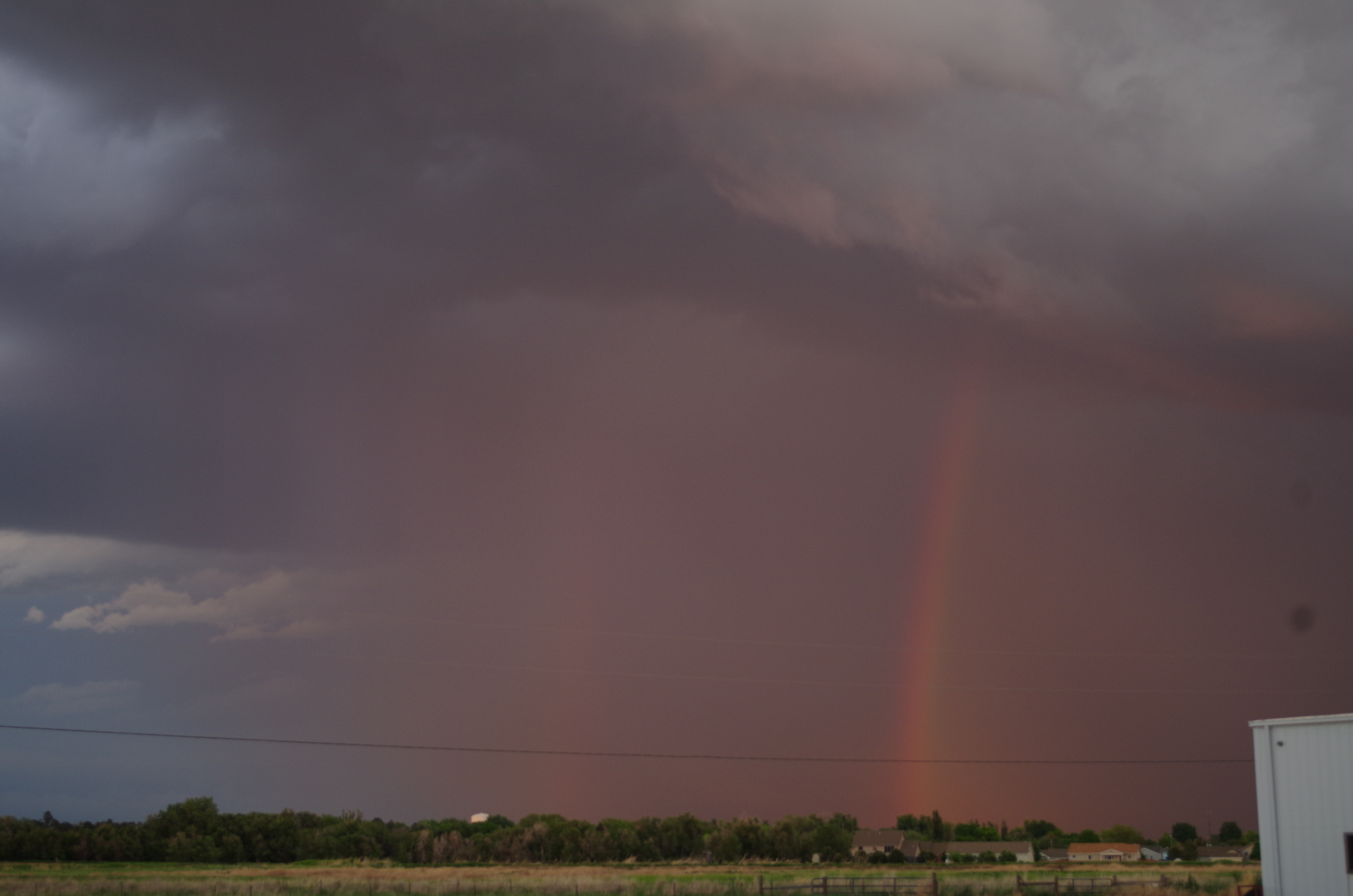
Calling it a day, we left our storm cell and headed to Scottsbluff, Nebraska for dinner at a Sonic. However, Mother Nature wasn’t nearly done with us. As we were grabbing food, another storm popped up right over the city. A rainbow appeared as the rain from the storm refracted the incoming light from the setting sun. On top of that, hail began to fall, which was surprising because hail is usually a tell-tale sign of a strong thunderstorm with intense updrafts. Hail and a rainbow? Wow, that’s incredible. But the atmosphere still wasn’t done with its fun. The storm quickly intensified as rain and pea-sized hail started to pick up in addition to approaching thunder and lightning. Realizing that the situation was quickly escalating, Dr. Decker had us quickly pile up into the vans to retreat westward to avoid the storm rapidly approaching from the southwest. However, moments before, Sherilyn ordered a Sonic shake, so we couldn’t evacuate until she got her shake, which was a long four minutes that felt more like five minutes. Once Sherilyn got her shake, we punched it westward just in time to dodge the storm. What we saw then was simply incredible! As the sun was setting, it turned the towering cumulus of the quasi-supercell into a stunning red, orange, and gold spectacle. On top of that, the base of a double rainbow appeared along with frequent strikes of CC (cloud-to-cloud) and CG (cloud-to-ground) lightning!
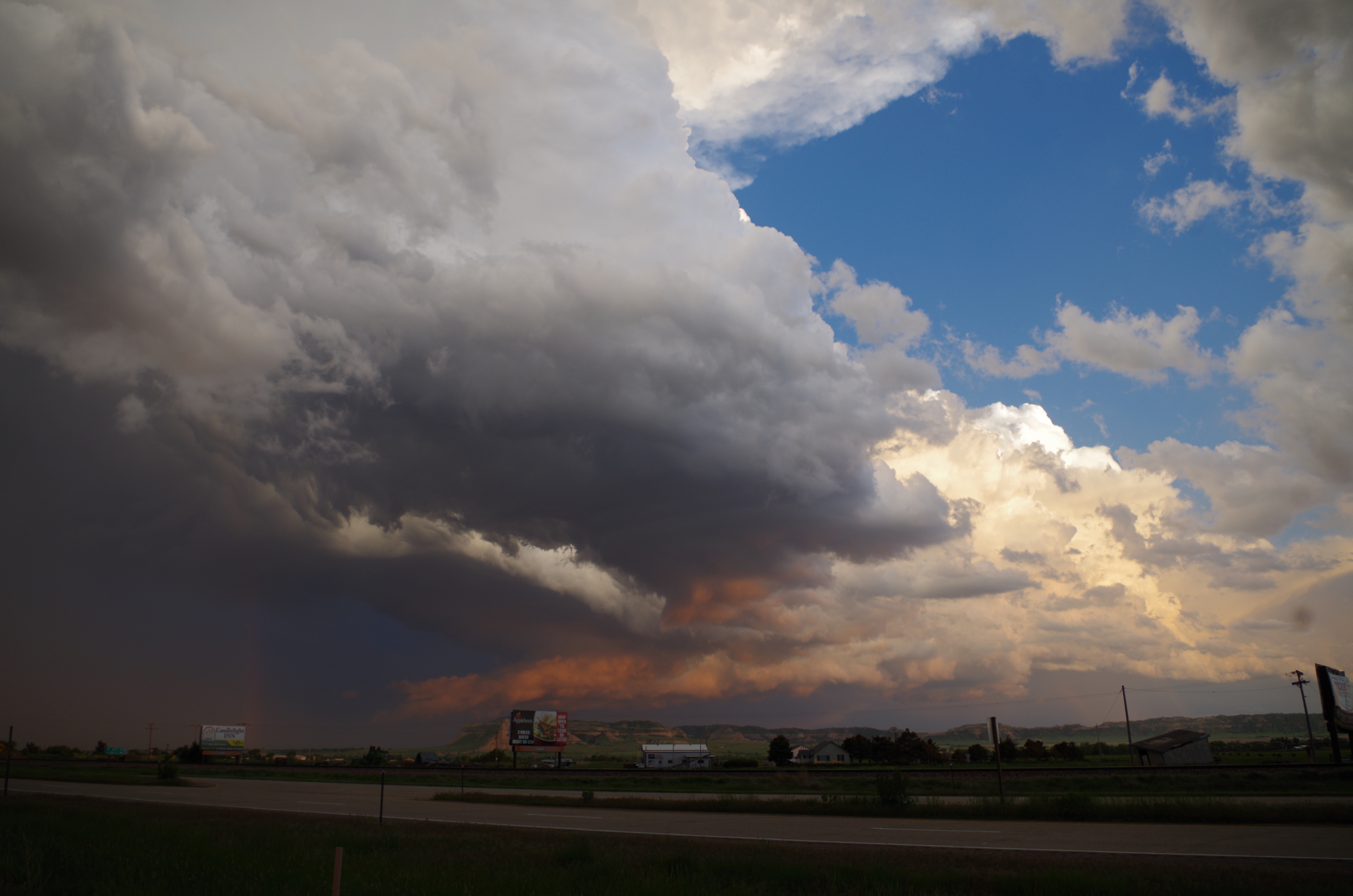
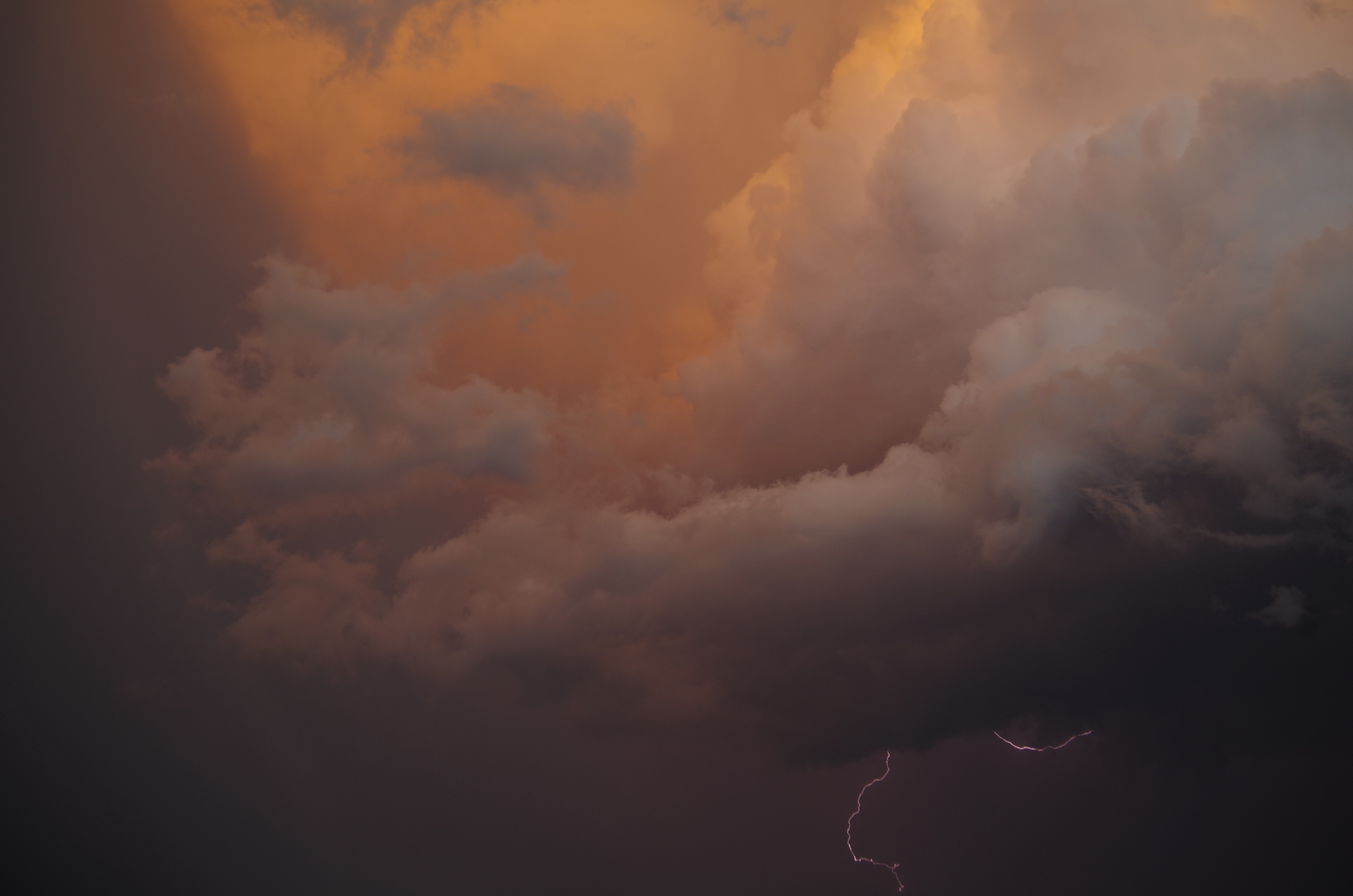
Suddenly, the quasi-supercell developed a strong rotating wall cloud right next to the geographical Scottsbluff structure!
So we had a multi-colored cumulonimbus quasi-supercell thunderstorm producing frequent lightning with a double rainbow and a rotating wall cloud right next to Scottsbluff all at once! Needless to say, I was freaking out, stormgasming even!
As the sun set, we followed this storm complex back to our hotel, viewing a wonderful nighttime lightning show. What a way to end a chase day. Definitely not catching that twister we’re in pursuit of, but an amazing spectacle of how stunning our atmosphere can be for sure.
