Friday, June 6th
Well, I won’t keep you in eternal suspense like a terrible two-part Russel T. Davies Doctor Who episode – YES, WE SAW A TORNADO TODAY! WE DID IT!!!! WOOHOO!!!
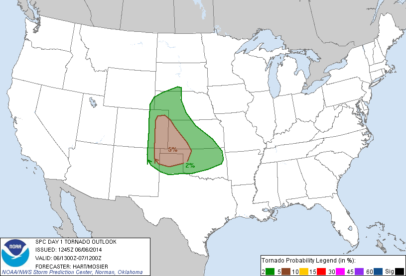
Our successful story begins in Clayton, New Mexico. The SPC put a large area of the country, from Colorado to Georgia, under a Slight Risk for severe weather. The probabilistic risk for tornadoes was concentrated in the Colorado/New Mexico/Texas/Oklahoma/Kansas border.
Our own analysis found the best probability for us to intercept a visible tornado lied in SE Colorado and NE New Mexico. Completely tired of driving the same roads in Colorado, we decided to head for Clayton, New Mexico. Eating lunch then waiting at a local park (you know, the usual), we found out via social media that a nice tornado touched down in SE Colorado, fully visible and everything.

Moving past our missed opportunity, more storms began popping up in NE New Mexico. Finding our target cell, the “tail-end Charlie” of the group, the last cell in a line of thunderstorms, we headed west down the empty roads of New Mexico. A big challenge for us was that the road networks in New Mexico were absolute rubbish! However, a potentially bigger challenge for us was our wireless data networks. All four major wireless carriers were represented on the trip: Verizon, AT&T, Sprint, and T-Mobile. Out of the four, oddly enough, only T-Mobile had sufficient coverage in the middle of nowhere New Mexico! Verizon’s coverage was spotty, and AT&T and Sprint had nothing or were roaming. Throughout the entire trip in Nebraska, Wyoming, and Kansas, I was roaming with T-Mobile while my friends with Verizon and AT&T had 4G/4G LTE on Bob’s road… needless to say it was a terrible experience. But alas I had data! However, that wasn’t the greatest thing in the world. Dr. Decker’s data card for his laptop was for Verizon, which meant it was almost entirely up to me to keep track of the storm. LOTS of pressure.
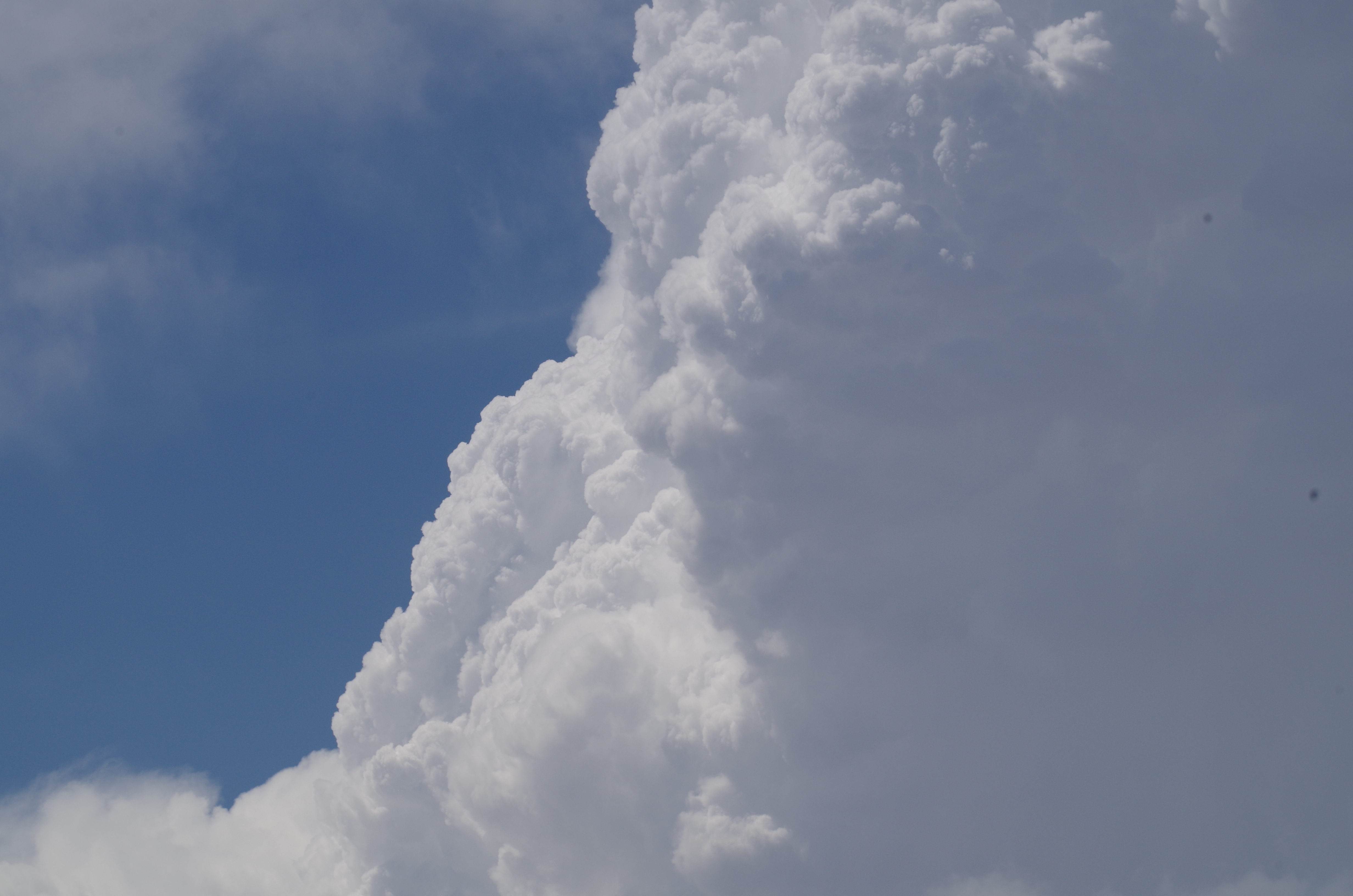
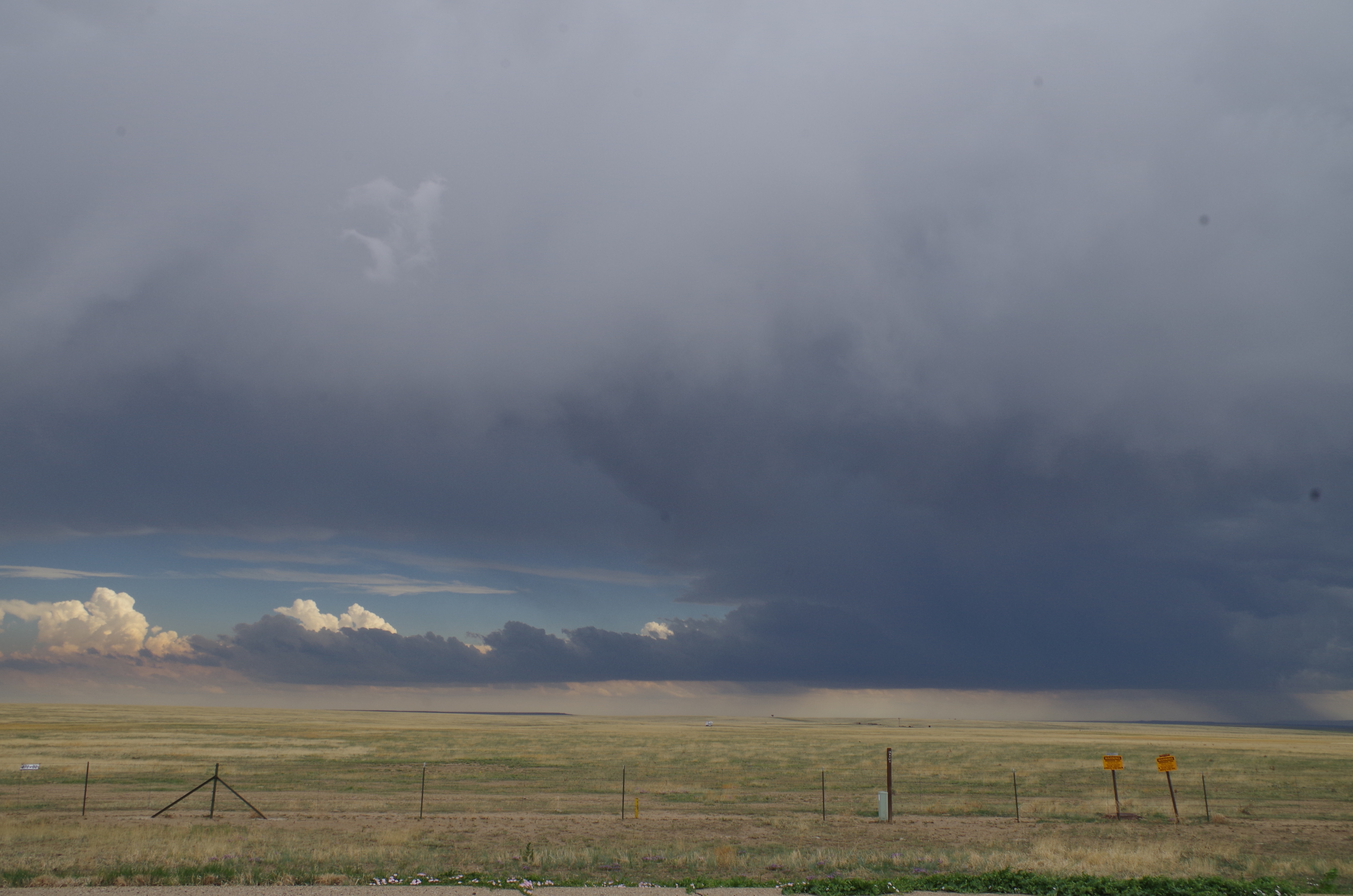
Upon arrival to our target cell, it didn’t look so impressive on radar, but in person, it was a monster. This brought up a new challenge for us – radar coverage. Where we were, radar coverage was bad, really bad. The closest radar was about 140 miles away, right along the fringe of a radar’s range. This meant that radar data was unreliable and that we were all on our own, with only our senses to guide us. Radar was telling us that a cell to our south was stronger and more worthwhile, but our eyes and gut feeling told us otherwise. We stopped on the shoulder of the road between both of the storms to get a better feel for each cell. To our north was our target cell, and what a beast it was! Winds were extremely intense as the inflow to the storm sucked in all the warm, moist air around us. This was a good sign that the storm was strengthening. On top of that, we saw more hints that this cell was intensifying: a long and filled inflow tail was feeding moisture into the cell aloft, the cloud base was becoming lower by the second, and the cumulonimbus anvil cloud was still rapidly growing.
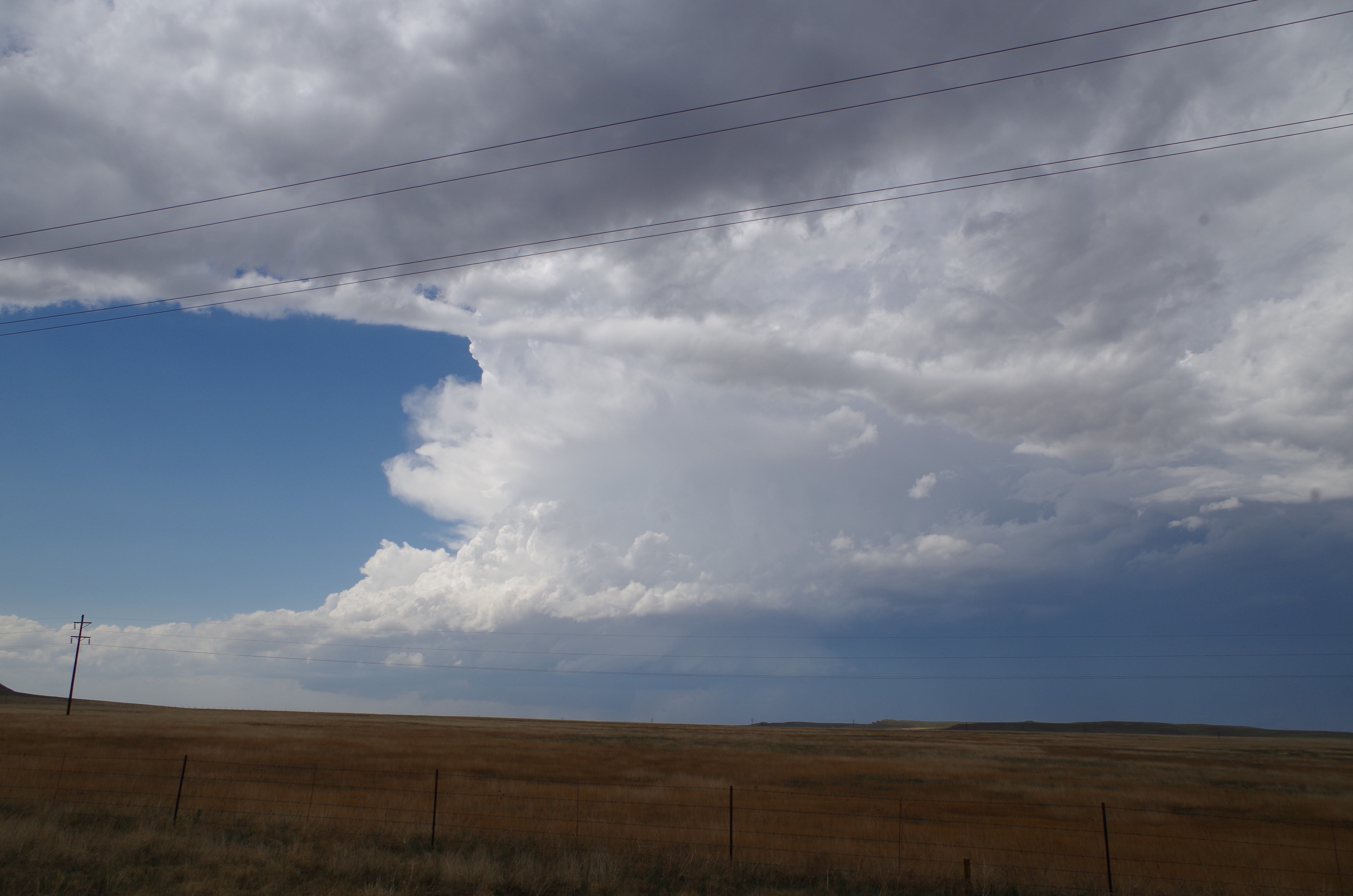
In contrast, our southern storm was not as impressive. Sure, it looked darker and more ominous, but once you get past the coloring (which depends fully on which angle of the storm you’re looking at), it was not all that great of a storm. It did have a nice inflow tail, but the cloud base was not very low, nor did we really see anything particularly great about it.
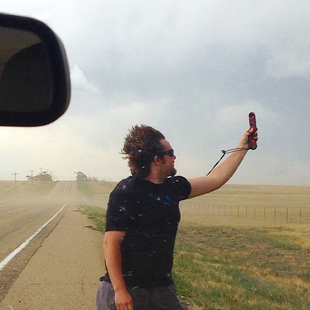
Analyzing the situation, we decided to stick with our target cell, as it looked more promising to us (plus the road networks were terrible, so going after the southern cell meant heading east back to Clayton, going south, then going back west… nope, we were stuck with the cell we had). Moving slightly east to avoid the cell as well as a unique “left-mover” (a leftward break-off of a cell that rotates in an anticyclonic fashion) that the southern cell produced, we encountered intense inflow from our target storm. Tumbleweeds were flying across the road, one of which slapped the side of Broccoli, scaring the life out of our passengers. We pulled over for a moment to quickly measure the wind gusts that this inflow was producing. Our own daredevil Joe Slezak hopped out of Scarlet and stood in the intense inflow as dust and tumbleweeds flew by him to measure an impressive wind gust of 47.2 mph.
Driving east again, we passed by a down telephone pole, most likely caused by the inflow winds. This is a good place to remind all of you that straight-line winds can be as damaging as tornadoes!
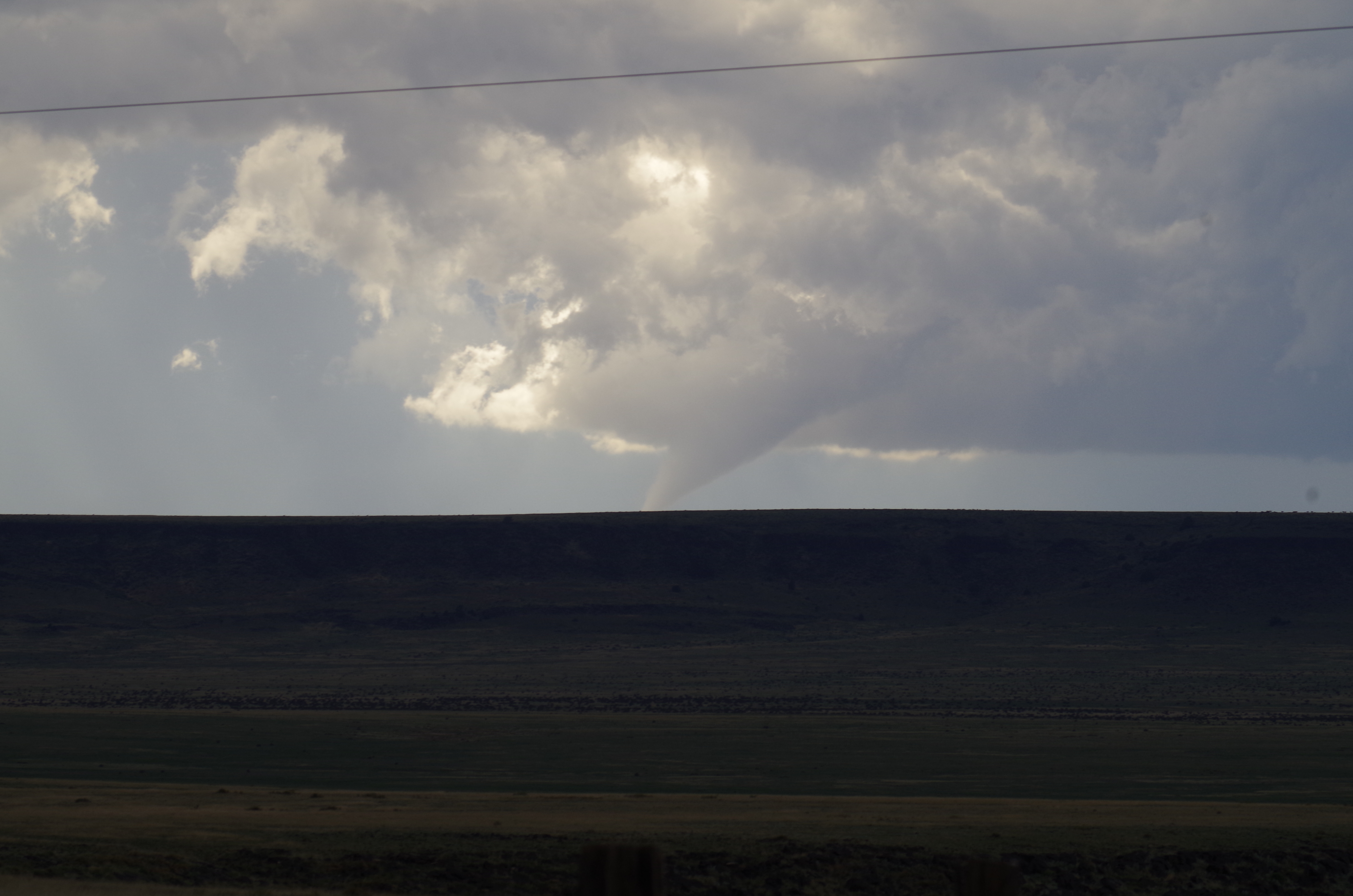
Suddenly, Scarlet, the lead van, breaks and pulls over quickly and Dr. Decker announces on the radio that there is an interesting cloud formation to our 7 o’clock that we should all look at. And there it was, a dropping funnel cloud.
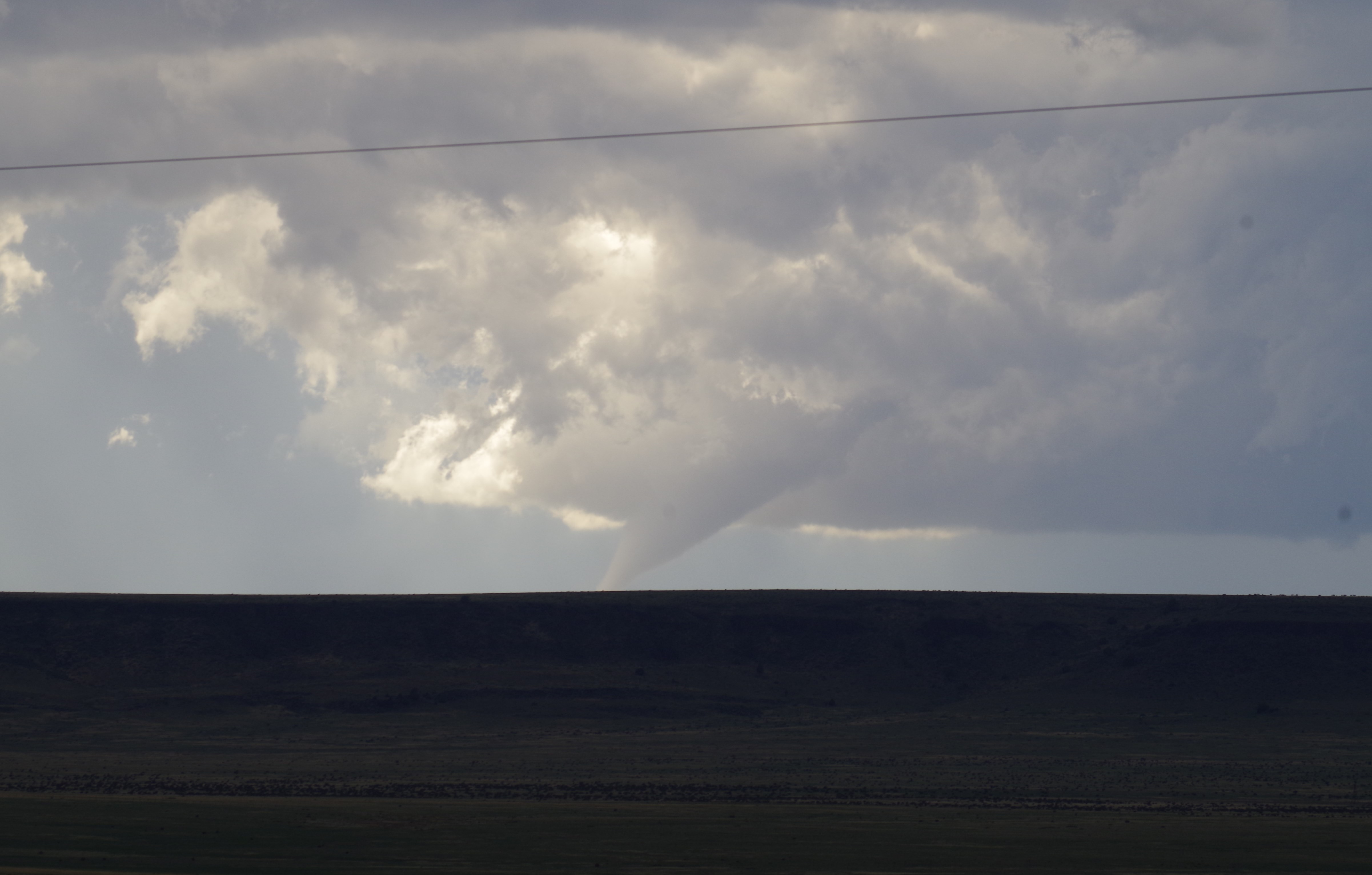
It fell quickly right before our eyes, but the ground was blocked by a plateau and we couldn’t be sure it was a tornado. Other storm chasers called into the NWS and reported that the funnel had in fact made contact with the ground, initiating the tornado warning with the cell. The NWS later confirmed that this was a tornado, making it our official first tornado intercept! As quickly as it dropped, it went back up, initiating us to head off again.
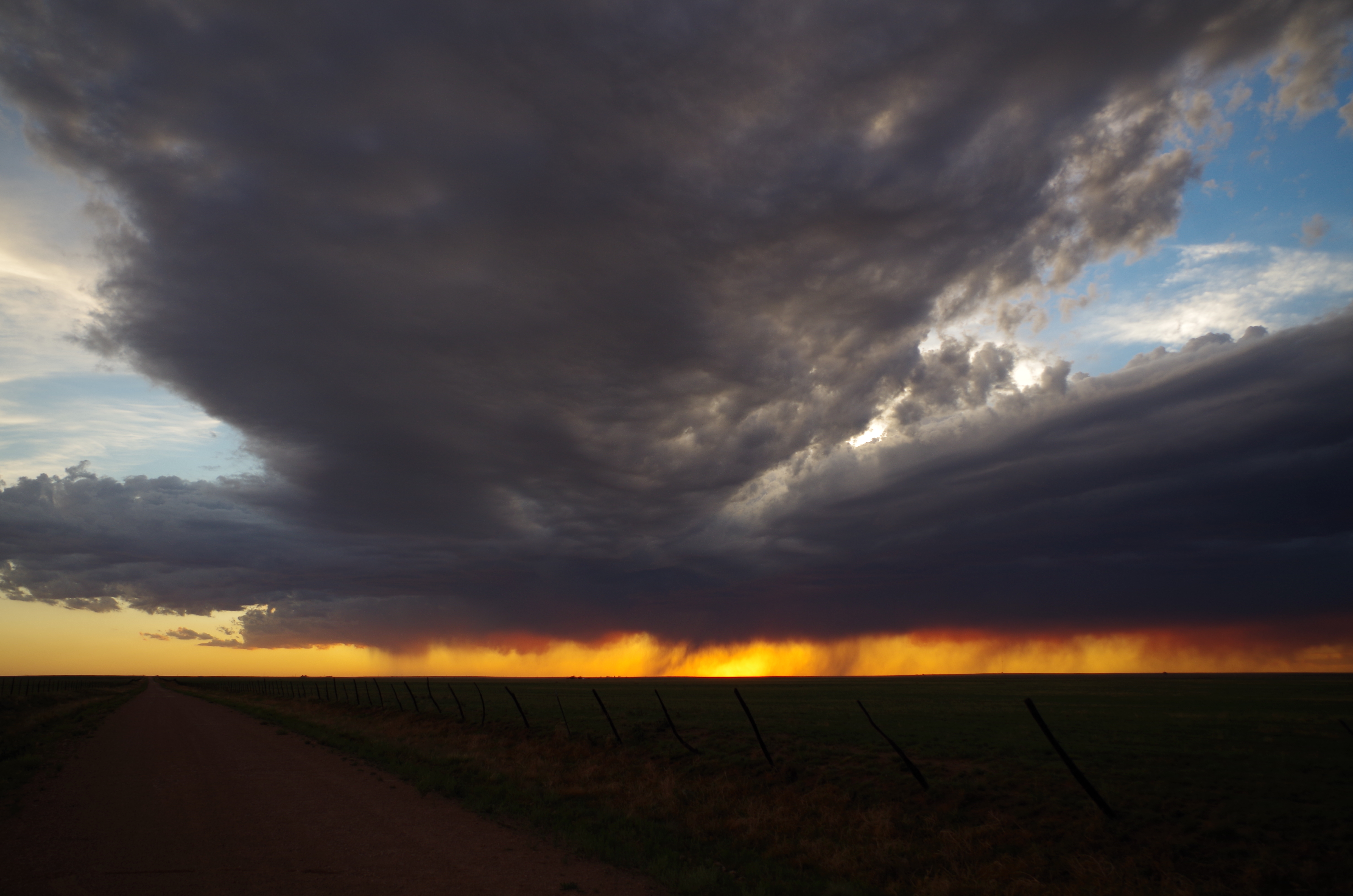
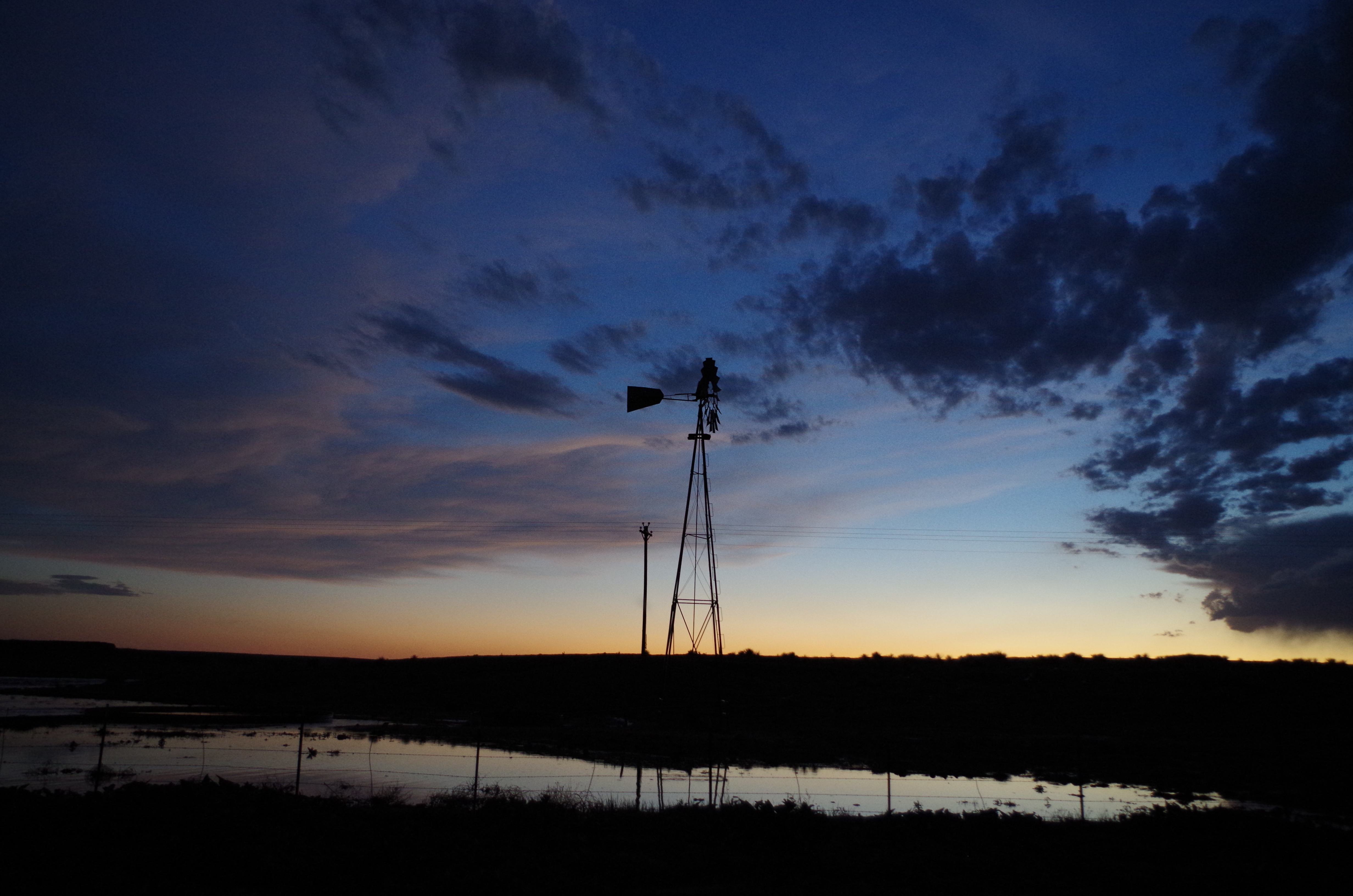
As we shot eastward, the storm cells began merging into a large complex that we had to avoid. Making it to Clayton once again, we topped off our tanks and shot northward a few clicks to avoid the mass chaos. Seeing that the storms would pass just south of Clayton, we went back to town for dinner. Afterwards, we found a route that would lead us around the storms to get to our hotel. We stopped on a dirt road to take a few beautiful sunset photos with a weak storm cell just to our west.
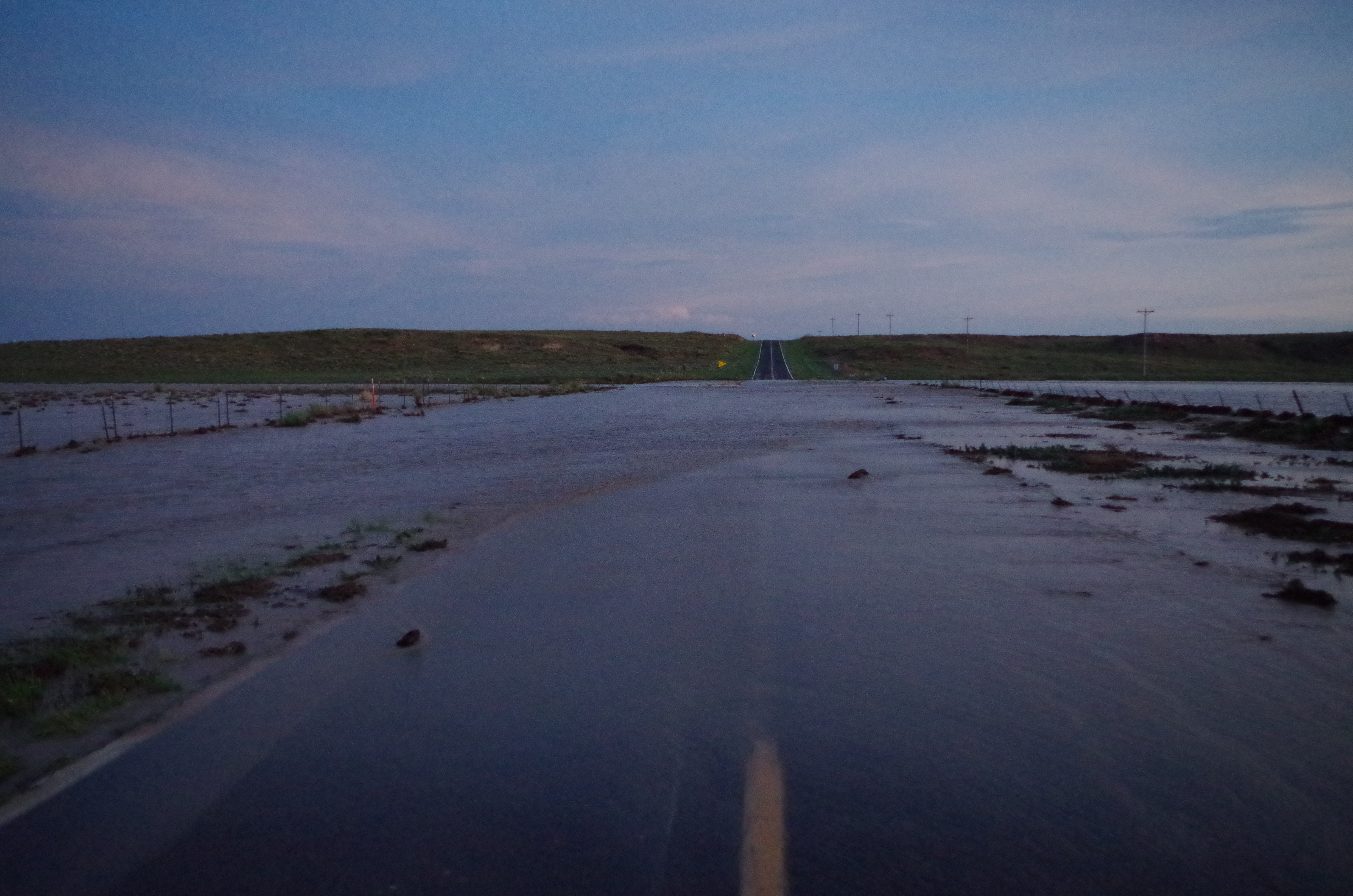
 Continuing our drive, we actually ran into a flooded roadway that prevented us from taking our desired route. A local stopped us before we drove into the flooded area, letting us know that 4 feet of moving water was covering the road. The local said these storms were the worst in 25 years he’s ever seen.
Well folks, a bunch of meteorologists had to take our own advice – turn around, don’t drown. Which meant we had to take a long, long detour to get to our hotel.
