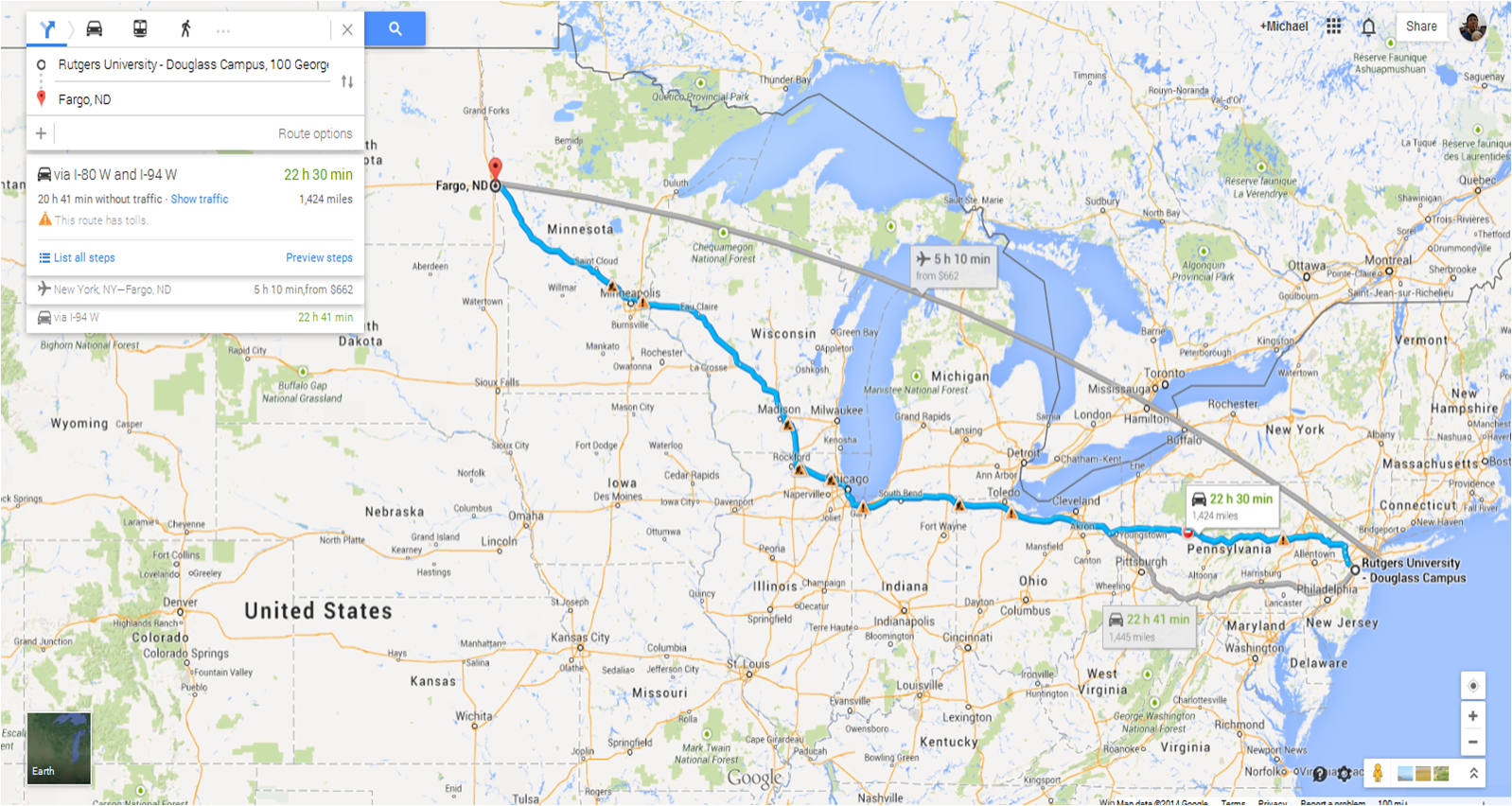
We’ve officially devised a plan of attack for the next couple of days! Our first targeted area for the trip will be in the Northern Plains in the Dakotas and eastern Montana! It’ll take us 2 straight days of driving to get there (oy vey!) through the Central Atlantic and the Great Lakes regions. If you’re looking for a more exact drive time, it’s about 22 hours of straight pedal to the metal!!! (Not really though, we must drive defensively!)
 Why the Northern Plains you ask? Do they still have snowcover from this crazy winter??? Luckily no; if there was still a snow pack there, I would probably have lost my mind, although a snow-white tornado would be pretty awesome (Snownado?). At any rate, the Northern Plains for Friday and Saturday look somewhat probable for severe weather development. There are 4 key factors that you want to look for in severe thunderstorms, specifically supercell thunderstorms, development: instability, moisture, lift, and shear. [I’m about to explain what each parameter is, so skip to the next paragraph if you want to pass over this] Instability is essentially a measurement of how much energy the atmosphere has stored in it. It’s measured by a parameter called CAPE (Convective Available Potential Energy). Essentially, bubbles of heated air (called parcels) at the surface becomes more buoyant than the surrounding atmosphere and starts moving up and up and up. Think of it as a hot air balloon – the more the balloon is heated, the more buoyant it becomes and the higher it goes. Eventually, these parcels become clouds and depending on how unstable the atmosphere is, these clouds grow higher and higher until they’re massive thunderstorm clouds. If the atmosphere is stable, no parcel will make it up. Moisture is pretty straightforward: humidity in the atmosphere. The more moist the atmosphere is, the more likely clouds will form that will lead to thunderstorm development. Lift is just another mechanism that pushes parcels of air upward. Lift becomes especially important when the atmosphere is stuck between an unstable and stable state (called conditionally unstable). Shear is the final straw that breaks the camel’s back. Shear is when wind speed and/or direction differ with height. Think like rolling a can of soda between your hands – move one hand, and the can turns. This is that rolling motion in a thunderstorm that can cause a tornado. In addition, if that rolling motion starts spinning around like a top, that’s when you get a supercell thunderstorm and a really good chance for a tornado.
So now that I attempted to compress an entire semester’s worth of meteorology into a long paragraph, all you really need to know is that for Friday, forecast models have these 4 parameters looking decent, not ideal, but acceptable, so we’re taking a gamble and testing our luck. Tornadoes don’t need 100% ideal conditions to form, so we could just get lucky. Saturday, however, looks a bit better and we’ll be in perfect position for that day.
With safety being the #2 priority in this trip (seeing a tornado is #1, right?), we also went over a few safety rules and certain plans of action, such as where we will position ourselves for the safest and most ideal viewing of a storm cell and how we will travel around a storm (no hail core punching for us!). But one of the most important rules that we have to follow is this: “No Stormgasms”.
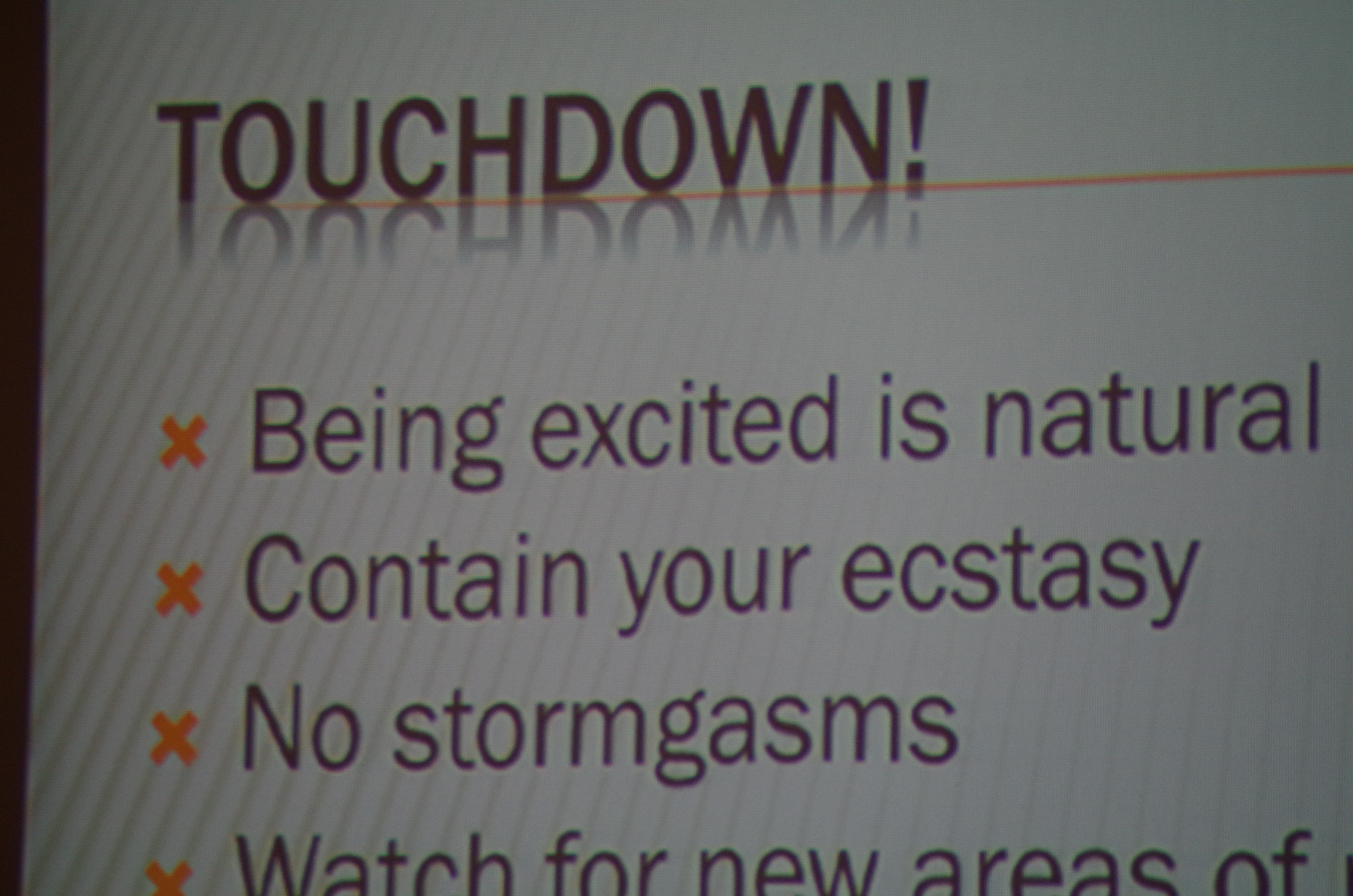
Uh oh, I think I’ll be in major trouble… No stormgasms? I mean, come on Dr. Decker, that’s what I do – that’s what every weather-weenie does! I also need to contain my ecstasy while a tornado touches down? Well, I may as well just take an “F” now… I’m not sure I’ll be able to do either… Probably the best for us though. It’s these stormgasms that get us into real trouble because we suddenly all want to be Reed Timmer or Sean Casey with the Dominator or the TIV and dive right into the heart of a tornado.
